When I saw O's example, the first thing I thought of was the Paint-by-Numbers pictures. Then after reading the info in the links, I thought of the topographic maps produced by the United States Geological Survey - instead of elevation contours, we get luminosity contours.
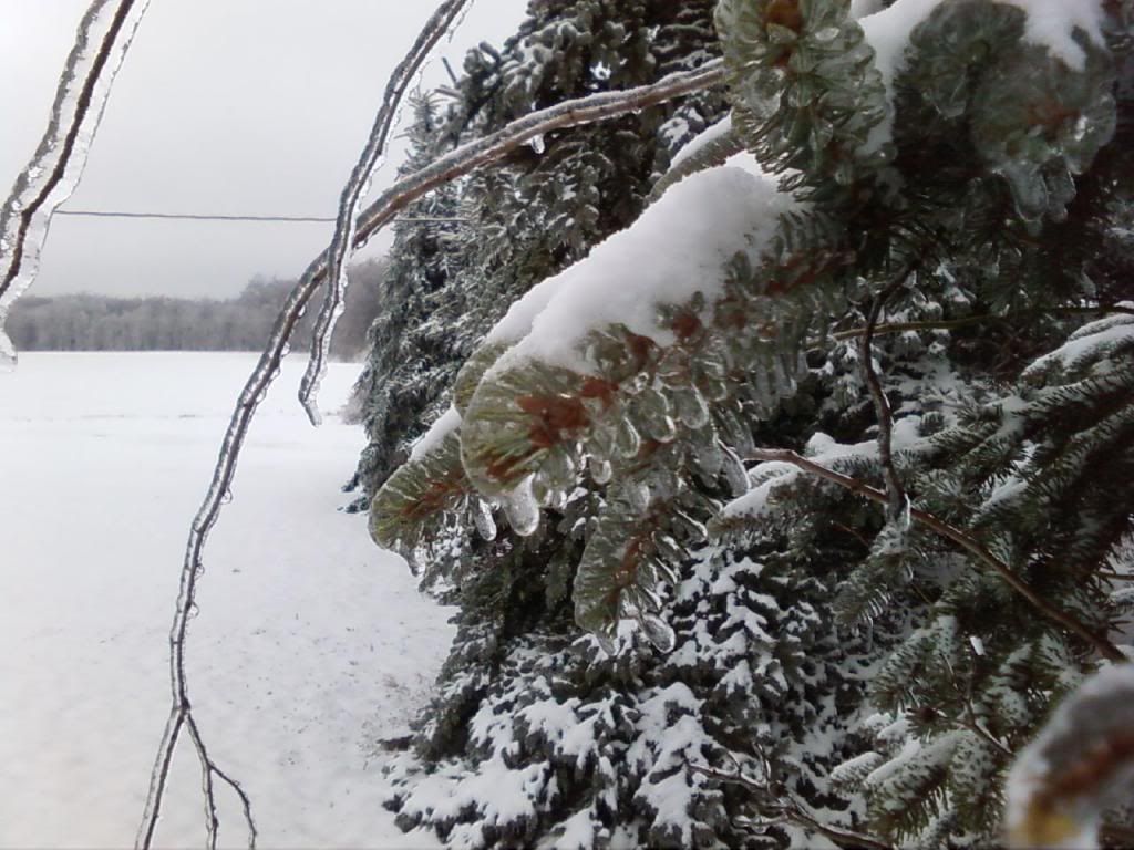
Here's a picture of mine which I took a few years ago following an ice storm (took it with my cellphone, no less!). The original image is
here. I used a the same image prep (dup layer, desaturate by luminosity) and settings in G'MIC as O did. Once G'MIC finished I set the layer mode to Darken only. What was so interesting for me was that the filter picked out detail in the cloud and snow that I couldn't really get (or see) playing with the regular Brightness/Contrast sliders, and how changing the layer mode really changed the appearance

I probably never would have experimented with this if I had not seen this thread.


 thank O !

